

- This event has passed.
Looking Slowly at Early Modern Maps
Tuesday, May 14, 2019 @ 5:15 PM - 6:45 PM
Royce Hall Room 306,
10745 Dickson Plaza
Los Angeles, CA 90095 United States + Google Map
Los Angeles, CA 90095 United States + Google Map
Co-sponsored Workshop
About a decade ago Malcolm Gladwell in his 2005 book Blink: The Power of Thinking Without Thinking lauded the ability of art connoisseurs and other experts to make rapid judgments based on a small amount of information. While interesting and well-suited to our short-attention-span culture, the book leaves by the wayside the essential insights about works of art and other objects that can only be achieved through patient contemplation. The practice of “slow art” originated in the eighteenth century, and has been emphasized in recent books by Arden Reed (Slow Art: The Experience of Looking, Sacred Images to James Turrell) and Shari Tishman (Slow Looking: The Art and Practice of Learning through Observation).
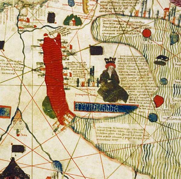
In this workshop, Chet Van Duzer discusses several early modern maps to demonstrate the value of applying patient contemplation to cartography, provides ideas about the types of conclusions that can be reached through slow looking, and shows the richness of early maps as objects for study. Advice on how to study maps slowly will be followed by consultation of historic maps (originals or facsimiles, as available at the institution) by the workshop participants.
The maps that will be analyzed:
- Martin Waldseemüller’s world map of 1507
- a French manuscript world map from 1550 (British Library Add. MS 24065)
- an Italian manuscript atlas of nautical charts from the first quarter of the sixteenth century (Huntington Library HM 217)
- an Italian manuscript world map from the early sixteenth century (Huntington Library HM 45)
- the Catalan-Estense world map of c. 1460 (Modena, Biblioteca Estense Universitaria, C.G.A.1)
 Chet Van Duzer is a Researcher in Residence at the John Carter Brown Library and a board member of the Lazarus Project at the University of Rochester, which brings multispectral imaging to cultural institutions around the world. He has published extensively on medieval and Renaissance maps in journals such as Imago Mundi, Terrae Incognitae, Word & Image, and Viator. He is the author of (with John Hessler) Seeing the World Anew: The Radical Vision of Martin Waldseemüller’s 1507 & 1516 World Maps. His book Sea Monsters on Medieval and Renaissance Maps was published in 2013 by the British Library, and is now available in editions in German, Russian, and Chinese (both mainland and Taiwan). His book The World for a King: Pierre Desceliers’ Map of 1550 was published at the end of 2015 by the British Library, and in 2016 Brill published a book he co-authored with Ilya Dines, Apocalyptic Cartography: Thematic Maps and the End of the World in a Fifteenth-Century Manuscript. In 2017 he co-authored with Lauren Beck a 270-page exhibition catalog titled Canada before Confederation: Maps at the Exhibition, which was published by Vernon Press. In 2018 Springer published his book Henricus Martellus’s World Map at Yale (c. 1491): Multispectral Imaging, Sources, and Influence. His recent NEH-Mellon project at the Library of Congress was a study of the annotations in a heavily annotated copy of the 1525 edition of Ptolemy’s Geography; he recently completed a David Rumsey Research Fellowship at Stanford and the John Carter Brown Library studying Urbano Monte’s manuscript world map of 1587. His current project is a book about cartographic cartouches.
Funding for this event is provided by the Armand Hammer Endowment for the UCLA Center for Medieval & Renaissance Studies and the UCLA Department of History.